Out of the (3) Sangla’s:::::
Sangla, India & Sangla in Nepal & Sangla Hill, in Pakistan - this information is with regards to Sangla and Chitkul here
in our dev bhoomi, our state of Himachal Pradesh, India.
In Himachal Pradesh, Kinnaur,
the tribal district lies 250 km away from Shimla and is situated on the NH - 22
(Hindustan Tibet Road).
 |
| Valley View - Sangla (towards Chitkul village) |
Getting there:
Option 1) – (2 days
from Delhi)
From Delhi arrive at
Shimla. (9 Hrs.) (Stay here).
The next day proceed
to Narkanda then to Rampur, Tapri to Sangla to Chitkul. (9 Hrs.)
Shimla to Rampur is 3
hours. Rampur is the district headquarters of the present district of Rampur,
the capital of erstwhile kingdom of Rampur-Bushair whose rulers ruled all over
the Kinnaur valley upto Kullu. Situated on banks of river Sutlej, its a
fertile valley and still houses the palace of the erstwhile rulers. Being
situated in the base of the valley, at an altitude of barely 1100 meters, it is
hot in the summers. One passes through Hydro-electric power stations
after Rampur which have been built by putting dams across the mighty
Sutlej. One comes across Naptha (Naptha-Jakhri project), followed by
Wangtu & Karcham, which are being developed by the Jaypee Group. For
going towards Sangla, one has to take the diversion across the bridge across
Karcham and the ascent towards Sangla begins from here.
Option
2) (2 to 3 days from Musoorie)
From
Musoorie follow the road to Tons Valley and enter Himachal at Tiuni ... from
Tiuni continue journey till Hatkoti situated amongst apple orchards. Stay at the tourist guest house here ... this
is a 6 Hr. journey from Musoorie ... Then Hatkoti to Sarahan again a 6 Hr.
journey .. and ultimately to Sangla ...
Best
time to visit the beautiful Sangla Valley
is in the months between April and June and again September and October.
Sangla is a scenic hill-town in the Baspa Valley, also
referred to as the Sangla valley, in the Kinnaur District of the Indian state
of Himachal Pradesh, close to the Tibetan border. Sangla Valley is located in
Kinnaur Distict of Upper Himchal Pradesh, India. Of all the side valleys of
the river Satluj, the Sangla valley (literal translation means - ‘Sang’ is
light & ‘La’ is pass - in Tibetan) is perhaps the most
picturesque one that curves along the ‘Baspa river’. Unlike most other
major streams of the area that flow north to south, the river
Baspa arises in the mountains of adjoining Uttrakhand and flows
north-west to meet the churning torrents of the river Satluj at Karcham.
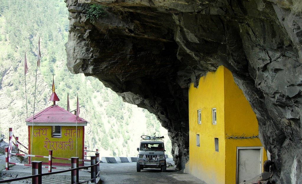
 |
| Tapri to Sangla |
The road leading to the Sangla Valley is challenging in
part. Situated on the banks of river Baspa, the Sangla Valley boasts of Kinner
Kailash Peak which can be seen from the Sangla Village. The Kinner Kailash peak
is the said to be winter home of Lord Shiva. The valley is surrounded by richly
forested conifer slopes and offers delightful views of the high mountains. The
Baspa hydel-project is nearing completion, only adds to the growing importance
of this destination.
Sangla village is on a slope with houses rising one above
the other with gigantic Kinner-Kailash peak (6,050 m) towering over it. Sangla
is also famous for Kamru Fort. This fort was the place where rajas of Kinnaur
were crowned. Now this fort is dedicated to Kamakshi Temple. The Goddess idol
was brought from Guwahati (Assam).Sangla is
situated at a distance of about 98 kms. from Rampur and is on the
hind side of the Kinner Kailash range. The valley is about 95 km long,
starting from Karcham (1899 m) at one end to Chung Sakhago pass
(5242 m) at the other. The famous village of Chitkul (3450 m), is situated
in the middle of this valley, is the last inhabited village here in India-Tibet
border.
Baspa valley’s highest village is Chitkul and the last
village on Hindustan – Tibet road, where tourist can go without permit. The village comprises of three temples of Goddess Mathis in
the village and it is being said that they are 500 years old. It is a friendly
place for trekking. The place provides beautiful scenic place apart from that
it also provides ideal conditions for fishing on river Baspa. It is at a
distance of 24 kilometers from Sangla. Out of the three temples the Kagyupa
Temple has a highly valued old image of the Shakyamuni Buddha, a Wheel of Life
mandala and four Directional Kings on each side of the door. The goddess of
Chitkul is the only non Buddhist deity to whom respect must be paid by the
Parikrama pilgrims.
 |
| Enroute: Sangla - Batseri - Chitkul Village |
Chitkul is the last
inhabited village near the Indo-Tibet border. The Indian road ends here. During
winters, the place mostly remains covered with the snow and the inhabitants
move to lower regions of Himachal. Potatoes grown at Chitkul are one of the
best in the world and are very costly. Chitkul, on the banks of Baspa River, is
the first village of the Baspa Valley and the last village on the old
Hindustan-Tibet trade route. It is also the last point in India one can travel
to without a permit. Of particular interest at Chitkul are its houses with
either slate or wooden plank roofs, a Buddhist temple and a small tower.
However, there has been an increased use of tin-roofs, especially the high
school and the army/ITBP barracks.
The Kagyupa temple
has a highly valued old image of the Shakyamuni Buddha, a Wheel of Life mandala
and four Directional Kings on either side of the door. Chitkul is practically
the last point of the famous Kinner kailash, Parikrama as one can hitch a hike
from here onwards. After one crosses over the 5,242 m high Charang Pass, it is
a long and steep run down through slithery scree slopes to Chitkul(3,450m). The
powerful goddess of Chitkul is the only non-Buddhist deity to which respect
must be paid by the Parikrama pilgrims. It is believed that the local Deity is
related to the Deity of Gangotri and till recently the locals would carry the
Deity to Gangotri on foot over high mountain passes. Chitkul is situated around
40 km from Karcham, the place where road bifurcates from Hindustan-Tibet
Road (NH 22). The Sangla Valley is a delight for nature lovers; especially the
stretch after Raksham and right up to Chitkul. The valley is extremely
beautiful, on the left bank of the Baspa River are snow-clad mountains and on
the right bank the whole terrain is full of apple orchids and wooden houses.
Chitkul is around
569 km from the National capital Delhi and 24 km from Sangla. This is
the last Indian village on border with China. The road doesn’t take you till
the actual border, it closes around 90 km before it and then rest of the
area is under the control of Indian Paramilitary force ITBP. There are wooden houses
turned into hotels that can be found in Chhitkul, these hotels are a bit
expensive and most of the tourist prefer to stay at Sangla and make a day trip
to this place. Sangla is close to Chhitkul and hotels and camps provide very
good arrangement for living and are comparatively cheaper. While in Chhitkul
make sure you carry adequate cash and petrol or diesel for your car as there is
no ATM facility or fuel stations in this hilly area. There is also neither a
clinic nor any hospital in this area and one has to travel back to Sangla for
emergencies. Chitkul is very cold and windy and the road normally closes down
around November after the first snowfall.
Famous
for:
Kinnauri Shawls: This beautiful hand
woven shawl with colorful borders can be expensive but is lifetime souvenir.
- Kinnauri
Cap: This, mostly green and grey cap, is the most typical thing from this
area..
- Apples:
These are probably one of the best apples anywhere in the world. The
harvest usually happens in October.
- Chulli
(Wild Apricot) Oil: Used for massage for health purposes as well as a
cooking oil.
 |
| Authentic Kinnauri Winter Coats being produced |
Places
to Visit around Sangla:
- Batseri
- Devta Temple - fine example of local architectural style.
- Chhitkul
- Kalpa
- Narayan Nagini Temple - eclectic mix of Buddhust, Hindhu and local folk
beliefs
- Rakcham
- Sangla
- Before
Sangla ahead of Rampur is Sarahan - Bhimkali Temple
Trekking in Sangla Valley, Himachal Pradesh
 |
| Or simply relax - if hiking/trekking is not for you. |
Sangla
Valley, part of the region of Kinnaur. The Valley, also known as the Baspa
Valley, has been called the `most beautiful valley in the Himalayas’.
Stretching for 95 km, the Sangla Valley is watered by the Baspa river, which
meets the Satluj at Karcham, and by several smaller streams and springs. The
Sangla Valley stretches across what was once a glacier moraine but is today a
gorgeous swathe of green, dwarfed by the surrounding mountains. The clear
waters of the Baspa run between orchards of apple and apricot, through villages
where the houses have exquisitely carved wooden doors and steeply sloped slate
roofs.
Trekking
routes:
1. Along
the Sangla Valley
(Sangla-Kamru-Rakcham-Chitkul): The `basic’ Sangla Valley trek, this trek
follows the course of the Baspa River, from Sangla to Chitkul, the last
inhabited village in the valley. Start the trek at the Sangla village, the
largest settlement in the valley. Close to the village are two of the valley’s
biggest attractions: the Kamru Fort and the saffron farm. Kamru village, about
a forty-minute walk from Sangla, is an intriguing blend of Hindu and Buddhist
religion: a Buddhist temple where a local mural combines the Buddhist Mahakala
with the Hindu deity Hanuman is an interesting example of the native culture.
Kamru is also home to an old fort, constructed from wood and stone and decorated
with gabled roofs. On the outskirts of the village lies a saffron farm,
considered better than the one in Pampore, Kashmir.
From Kamru, walk on, 14 km along the bank of the Baspa river, to the village of
Rakcham. Rakcham is home to a pagoda-style temple decorated with fine wood
carvings. The village has accommodation and dining facilities (although
limited) and you can stay here for the night, before going on the next day to
Chitkul.
Chitkul, 25 km from Sangla village, is the last settlement along the Baspa; it
has a campsite and a PWD resthouse. Chitkul is a base for the Kinner-Kailash
pilgrimage; trekkers can either go further on the Kinner-Kailash trek, or walk
another 4 km to Nagasthi, the last Indian outpost before the Tibetan border.
Note that foreigners are not allowed to go beyond Chitkul without a special
permit.
2.The Kinner-Kailash Circuit (Morang-Thangi-Rahtak-Charang
La-Chitkul-Sangla-Kamru-Shang-Brua-Karcham): The mountain of Kinner-Kailash
(not the Mt Kailash, which is actually on the bank of the Mansarovar lake in
Tibet) rises to a height of 6,437 mt, towering over the Satluj river. The
annual Kinner-Kailash yatra is an important pilgrimage for thousands of devout
Hindus and Buddhists, but hundreds of avid trekkers also do the trip, for less
religious reasons. The trek, which is best accomplished in July or August,
takes about a week, and starts at Morang, on the left bank of the Satluj.
Morang lies north-east of Chitkul and is connected by road to Rekong Peo and
Tapri. You can spend part of the first day exploring the old monasteries of
Morang, before you proceed. The actual trek starts at Thangi, a short distance
from Morang, along the gushing waters of the Turung Gad torrent.
From Thangi,
walk 12 km up the valley to the village of Rahtak, where a tent can be pitched
for the night. The next day is an arduous trek up to the 5,266 mt high Charang
La Pass, after which the trail dips into the Sangla Valley. Follow the Baspa
River to Chitkul, then make your way to Sangla village, stopping en route for a
bit of sightseeing at Kamru. From Kamru, a trail leads, via Shang and Brua,
through Karcham, up to Kinner-Kailash itself. The trek up the mountain takes a
day in itself- or more, if you’re not in peak condition.
3.Chitkul-Doaria-Zupika Gad-Borsu Pass-Har ki Dun: This trek starts at
the fag end of the Sangla Valley- at Chitkul- and heads eastward into
neighbouring Garhwal, where it ends in Har ki Dun. Like the Kinner-Kailash
trek, this one too is a fairly gruelling one and should be undertaken only with
a good guide. The guide’s necessary not only because you might otherwise get
lost, but also to help you get the permits which are essential to pass through
the area. The Sangla Valley-Har ki Dun trek starts at the village of Chitkul,
at the end of the Baspa Valley, and continues across the river, up to the
village of Doaria, from where the trail leads right, heading towards Garhwal.
The trek then leads up to the Zupika Gad, and from there to the high Borsu
Pass. Descending from Borsu, you’ll come, in a few days’ time, into the
ethereally beautiful valley of Har ki Dun in Garhwal.
Even though the
Sangla Valley lies fairly close to India’s national border, no permits are
required to visit the area. Don’t venture beyond the valley without a permit,
though, as treks to Spiti and northern Kinnaur require an Inner Line Permit.
Please Note: Guides and packed meals are provided from Kinner Camp in Batseri
village. The trekking routes information has been taken from their website. For
latest updates on these routes you can contact them directly at www.kinnercamps.com
PLACES
AROUND SANGLA
KAMRU FORT
The fort is at a
distance of about 2 km from Sangla village and lies amidst picturesque
surroundings. This is one of the oldest forts of Himachal and the entry to this
tower-like fort is through a series of gates. At the main gate of the Fort is a
stunning image of Lord Buddha which greets every visitor to the fort. The
graceful wooden balcony, at the top of the fort, and the idol of Kamakhya Devi
believed to have been brought from Guwahati installed on the third floor of the
fort, are worth seeing. There is a Badrinath Temple inside the fort complex.
One can trek the whole distance or drive a car halfway to the Fort. This is an
half-day activity and best time to go is after breakfast so that one can return
for Lunch. No guide is required for this.
BASPA RIVER – TROUT
FARM
Sangla Valley is also
known as the Baspa valley which enters India at Chitkul near the China border
and then flows through the valley. This fast flowing river flowing through the
hill town of Sangla is a major tourist attraction. Fishing in the Baspa River
which is home to the rainbow and brown Trout is perhaps one of the greatest
attractions of Sangla valley. The swirling current of the Baspa is home to both
the rainbow and brown trout and is an angler’s paradise. There is a trout farm
near to the Camp ( approx 20 mins walk) which also sells Trout sometimes.
Crossing the Baspa River is another attraction of Sangla and provides the
perfect dose for adventure lovers. Camping along the bank of the Baspa
River provides a perfect setting for a day out with nature sitting in its lap
but one needs to be careful as mountain rivers are unpredictable and and can
cause accidents. The peaceful place and the friendly people of Sangla provide
the necessary boost for camping amidst such picturesque location.
KANDA – VALLEY OF
FLOWERS
If you are planning a
holiday in Sangla and wish to throw in a bit of exercise and adventure, this
short trek is ideal for you. This way, you can savour the beauty of the
pastures of Sangla Kanda without the exertion of the Rupin Pass trek. Enjoy the
Kanda over the afternoon after climbing up from Sangla. Spend the night (or
near) the Trekker’s Hut here and climb north -west the next day to cross the
Shivaling Pass back toward the Baspa Valley Once across, stroll down to the trekking
hut at Damabar, the pasture of Chansu Village. If time is not at a premium,
spend another night watching the moon over Raldang Peak, due north across the
Baspa Valley . From Dambar take to Chansu Village and Ruttrang Bridge, to reach
the motor road 3 km below Sangla.
A short trek to
Sangla Kanda Valley is approx 6 – 7 hrs. Four hours to go up and 2-3 to come
down. The view is amazing at the top with a lake and glaciers.